|
WORLD Illustrator EPS vector map
 World Map prepared in Illustrator EPS version 9.0 and features fully editable and customizable layers. The map has been prepared with a high level of detail and is fully rescalable when opened in Adobe Illustrator and Macromedia FreeHand. The map may be used with any of the relief maps shown on the main world map page to build a composite world relief map with overlying geo-political features. World Map prepared in Illustrator EPS version 9.0 and features fully editable and customizable layers. The map has been prepared with a high level of detail and is fully rescalable when opened in Adobe Illustrator and Macromedia FreeHand. The map may be used with any of the relief maps shown on the main world map page to build a composite world relief map with overlying geo-political features.
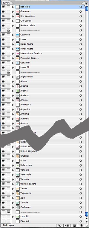
Any layer may be selected, edited for color and thickness or removed to build a map view to your specification.
Each country featured on the world map has its own layer which is individually editable for color fill.
Layers in Illustrator offer a high degree of selectability. The layers palette provide the ability to switch on selective features within each map. Layers are available for:
• Box Rule - outline box in 1 point around the map that fits the corresponding Mountain High Map
• Individual countries in 0.25 point, all country borders in 0.5 point, country names
• Coastlines in 0.25 point lines and white fills for lakes and inland water areas
• City locations, and city names
• Graticules of latitude and longitude
• Hydrography - river and tributary systems
• Linear scales in miles and kilometres
• Placed or Background Art, typically the layer used to place MHM relief maps
|
 World Map prepared in Illustrator EPS version 9.0 and features fully editable and customizable layers. The map has been prepared with a high level of detail and is fully rescalable when opened in Adobe Illustrator and Macromedia FreeHand. The map may be used with any of the relief maps shown on the main